How is this different to the North Fremantle Foreshore Management Plan?
The draft Foreshore Vegetation Management document responds to a number of recommendations in the higher order document North Fremantle Foreshore Management Plan , developed in 2013. It provides the necessary level of detail for specific vegetation management actions, which has not been addressed in the overall foreshore management plan.
How was the bushfire attack level (BAL) contour interval calculated?
The BAL contour maps and the contour intervals were specifically calculated for this project and for each vegetation area classified within the site. The complex BAL method 2 calculations take into account the fire danger rating, site slope, effective slope under the vegetation, fuel load and head fire width. All these factors and variables were used to calculate the BAL contour interval and was represented by the BAL Contour maps and the input data shown with the Appendix for validation if required.
How was the bushfire attack level rating calculated? Bushfire Risk Assessment
The current BAL ratings that have been calculated are indicative BALs based on the mapped classified vegetation, slopes and separation distances calculated based on BAL Method 2. In Western Australia, any new development must be constructed to the BAL-29 or lower rating and the development must be constructed to Australian Standard 3959-2009 if it is a Class 1, 2 or 3 building. With existing buildings, it is up to the landowner to manage their own bushfire risk within their lot. The new regulations and legislation are not retrospective.
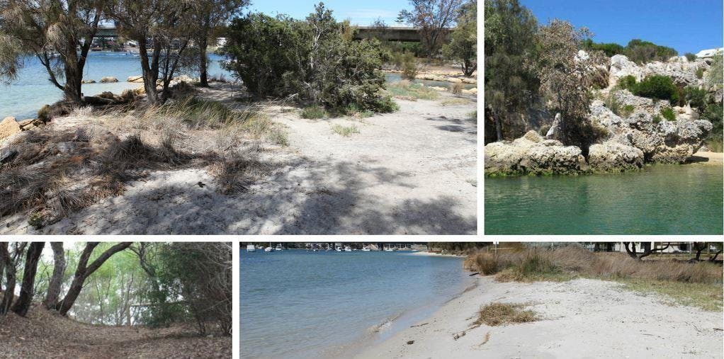
The bushfire risk assessment was undertaken on the reserve to define the potential risk. The current BAL ratings, the vegetation modification and other measures are proposed to retain some of the environmental values and reduce the radiant heat impact on nearby buildings.
The bushfire risk assessment was undertaken on the reserve to define the potential risk. The current BAL ratings, the vegetation modification and other measures are proposed to retain some of the environmental values and reduce the radiant heat impact on nearby buildings.
Does the report recommend seperating trees to reduce the potential for crown fire in the Rocky Bay trail and Cypress Hill areas?
Crown fire spreads from treetop to treetop
The modification of the structure of the fuel and vegetation in the Rocky Bay Heritage Trail (Area 5) and Cypress Hill (Area 6) is based on the change in fuel loads associated with the different vegetation types. In Rocky Bay we are proposing to change the vegetation from woodland to shrubland. This a change of 25 tonnes per hectare to 15 tonnes per hectare. The shrubland vegetation will be shrubs and ground covers up to 2m in height and with the retention of the existing trees the fire behaviour will be reduced. The trees are proposed to be maintained as though they are in a APZ with limbs trimmed to 2 metres. The overall bushfire behaviour in the area will not be that of a woodland if the vegetation is modified.
The current Department of Fire and Emegency Services and Western Australian Planning Commission guidance of tree separation is 6m between tree trunks and buildings within an asset protection zone. Asset Protection zones are defined as the area within a lot boundary and the buildings in the North Fremantle area are limited by the size of the residential lots. The vegetation within the Rocky Bay and Cypress Hill area is outside of the asset protection zone requirements.
The development of a crown fire in the area is low due to the slopes involved, potential short run and the vegetation type in the area. The removal of trees within the reserves is not a specific requirement for a reduction of bushfire risk in the area as the main fire intensity is driven by the surface fuel load and by a reduction in this fuel structure and vegetation will restrict the potential development of any crown fires.
How will you manage environmental and cultural values of the area with bushfire risk?
The State Planning Policy 3.7- Planning in Bushfire Prone Areas has an objective to: “Achieve
an appropriate balance between bushfire risk management measures and, biodiversity conservation
values, environmental protection and biodiversity management and landscape amenity, with
consideration of the potential impacts of climate change” (policy objective 5.4).
Balancing bushfire risk and environmental values as well as cultural values is difficult at times and the reduction of fuel load proposed by modifying the fuel structure in some areas of the Cypress Hill and Rock Bay Heritage trail will reduce the bushfire risk/impact and allows the area to retain the environmental value. The Aboriginal and early European cultural values within the area can be managed alongside the environmental and bushfire factors.
What responsibilites does the City of Fremantle have under the under the Bush Fires Act (1954)?
The Bush Fires Act (1954) does not apply to a department of the public service, state agency or instrumentality unless it is prescribed under the regulations. The City and Departmnet of Parks and Wildlife are not required to install firebreaks or reduce fuels, however the City acknowledges the bushfire risk and will manage it appropriately. The DPAW also priorities and manage their risks appropriately.