FAQs
- Residential zoning with densities ranging from R40 to R160 to promote a variety of housing types.
- Legible movement networks for pedestrians and cyclists, as well as motor vehicles, with an emphasis on the north-south connection from the former Lefroy Road Quarry to Bruce Lee Oval and beyond.
- Quality public open space that responds to the site topography as well as providing opportunities for the retention and protection of existing mature trees on site, wherever possible.
- Retention of and reuse of materials found within the site and surrounding region, such as existing limestone.
- Commitment to best practice water and energy management practices, climate responsive design and innovative construction methods.
Is this a City of Fremantle project?
No. The proposed structure plan has been prepared by Taylor Burrell Barnett on behalf of DevelopmentWA.
The City of Fremantle has a legislative requirement to advertise the proposed structure plan for public comment as part of the assessment process, in accordance with Schedule 2, Part 4, cl. 18 of the Planning and Development (Local Planning Schemes) Regulations 2015.
What is a structure plan?
A structure plan is designed to coordinate the development of land within a specific area. It sets out the zoning and residential density codes, placement of public open space and infrastructure, and the location of key roads and movement links. It provides direction to landowners and the community on what type of development may occur and forms the basis for assessment and determination of subdivision and development applications within the structure plan area.
Although a structure plan may include illustrations showing buildings, these are only intended to show what may be possible in terms of built form under the structure plan. They are not necessarily representative of the building designs that may eventuate and do not form part of the application.
What is the process?
Following the community engagement period, City of Fremantle officers will assess the structure plan and any submissions made. They will then provide a recommendation to Council, who will decide whether they wish to support the structure plan, with or without modification. Council’s recommendation is then submitted to the Department of Planning, Lands and Heritage.
Department of Planning, Lands and Heritage officers make an independent assessment of the structure plan and any submissions made, taking into account the Council’s recommendation. They then submit their recommendation to the Western Australian Planning Commission.
Who will decide whether to approve the structure plan?
The Western Australian Planning Commission will decide whether to approve the structure plan with or without modification. They are the final decision-maker on all structure plans.
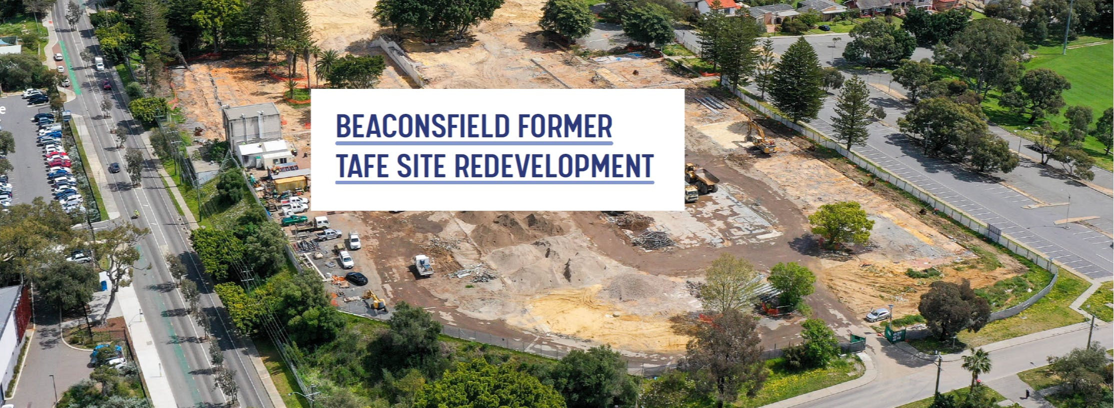
What does this structure plan propose?
The proposed structure plan would guide the detailed planning and design of the former Challenger TAFE site, in accordance with relevant State planning policy and local strategic planning objectives.
Key elements of the structure plan include:
What do the residential densities mean?
The structure plan divides the site into a number of areas that would be assigned different residential density codes. These density codes are based on the theoretical number of dwellings that could be built on one hectare of land. For example, R40 equates to 40 dwellings per hectare. The structure plan proposes R40, R60, R100 and R160 density codes. These would accommodate a variety of housing types, from single houses through to terraced townhouses and apartments.
Part 2, Sections 5.3.2 and 5.3.3 of the structure plan provide further detail.
It is anticipated that the plan would create 155 dwellings in total
What are the proposed building heights?
The building heights would be subject to the controls set out in State Planning Policy 7.3 – Residential Design Codes, Volumes 1 and 2. This means all dwellings in the R40-coded areas could be up to two storeys in height, while apartments could be up to three storeys in R60-coded areas, four storeys in R100-coded areas, and five storeys in R160-coded areas. The location of the various density codes has been considered in relation to surrounding development, which should ensure a gradual transition from lower buildings to taller buildings.
Would the existing trees be kept?
Yes. Over 50 mature trees are proposed for retention on the site, including as a feature of the public open space between Lefroy Road and Grosvenor Street. The tree species include Hills Weeping Fig, Norfolk Island Pine, Rottnest Island Tea Tree, and Horsetail Sheoak.
Appendix B – Landscape Report, pages 19 and 41 provides detail of the trees to be retained.
What would the public open space include?
The public open space would be landscaped to accommodate a variety of recreational uses and would provide foot / cycle paths, seating, and new planting, as well as retaining a number of mature trees. The southernmost extents of the two public open space reserves would incorporate swales to perform a limited drainage function during storm events.
Appendix B – Landscape Report, pages 43-57 provide detail of the landscape masterplan for the site.
Would there be any commercial uses in the structure plan area?
No. There are no plans for commercial uses within the structure plan area. However, the Davis Park Structure Plan, which covers the area to the east of Caesar Street, makes provision for expansion of the established neighbourhood centre at the intersection of South Street and Fifth Avenue.
How much traffic would the development generate and where would it go?
It is anticipated that the proposed structure plan would generate approximately 930 two-way trips per day, which is significantly less than the approximately 1,750 two-way trips that were generated by the former Beaconsfield Challenger TAFE. Road connections would be provided to Grosvenor Street, Caesar Street, and Lefroy Road (via Badham Close). The intended layout of the internal road network would discourage through traffic.
Has the Heart of Beaconsfield Masterplan been taken into account?
Yes. The proposal has been designed in accordance with the Heart of Beaconsfield Masterplan, particularly the building types and heights, the location of public open space reserves, and the strong pedestrian / cycle connection between the former Lefroy Road Quarry and Bruce Lee Oval.
The Heart of Beaconsfield Masterplan is available in Part 2, page 37 of the structure plan.
What is happening with the adjoining Davis Park Structure Plan area?
The Housing Authority has recently demolished a number of units within the Davis Park Structure Plan area. It is anticipated that detailed planning work for redevelopment will commence within the next few months. This will be dealt with separately from the proposed structure plan for the Beaconsfield Challenger TAFE site.
How do I make a submission?
You can make a submission via the City’s My Say Freo website or, if you prefer, in writing to the Chief Executive Officer, City of Fremantle, PO Box 807, FREMANTLE WA 6959.
Submissions should be made on or before 6 October 2023.
What may I comment on?
You may comment on any aspect of the proposed structure plan and its supporting documents. The City would welcome your opinions and local knowledge to help inform the decision-making process.
What happens to my submission?
Your submission will be reviewed by City officers and considered in their assessment of the proposed structure plan. A copy of your submission will be provided to the applicant to allow them to respond to any issues raised and to Council to assist in their decision-making.
A summary of your submission may be included in publicly available Council and Planning Committee reports. Personal details, such as your name and address, will be removed.